🚁 Advancing Tomato Crop Monitoring With Drone LiDAR and Remote Sensing
Collaboration with Alireza Pourreza, Ali Moghimi, and Mohsen Mesgaran
Digital Agriculture Laboratory | University of California, Davis
Research Overview
California tomato growers face increasing pressure from parasitic weeds, evolving climate conditions, and rising production costs. Early detection of plant stress and accurate measurement of crop biomass have become essential tools for ensuring yield, sustainability, and effective field management.
Building on the research originally highlighted by UC Davis ("Parasitic Weeds Threaten Tomato Plants on California Farms" – UC Davis News, 2023), I have expanded this work through drone-based biomass monitoring, integrating LiDAR, multispectral imaging, and machine learning to better understand crop development in real time.
Why Biomass Monitoring Matters
Parasitic Weeds
Broomrape (Orobanche spp.), a parasitic plant capable of severe yield loss affecting tomato fields across California.
Environmental Stress
Water stress, canopy thinning, and nutrient imbalance affecting crop development and yield potential.
Climate Variability
Climate-driven variability in phenology and growth patterns requiring adaptive monitoring approaches.
Traditional scouting often detects issues too late, after yield has already been reduced. That's where LiDAR-enabled drones make a difference.
Drone LiDAR for Tomato Biomass Estimation
Using a Matrice-series heavy-lift drone equipped with a LiDAR module, we map tomato fields at centimeter-level precision. LiDAR generates a dense 3D point cloud, from which we derive:
- Plant height models for growth monitoring
- Canopy structural metrics for biomass estimation
- Biomass proxies for yield prediction
- Early stress indicators for preventive management
- Detection of localized growth anomalies for targeted intervention
Field Research Documentation
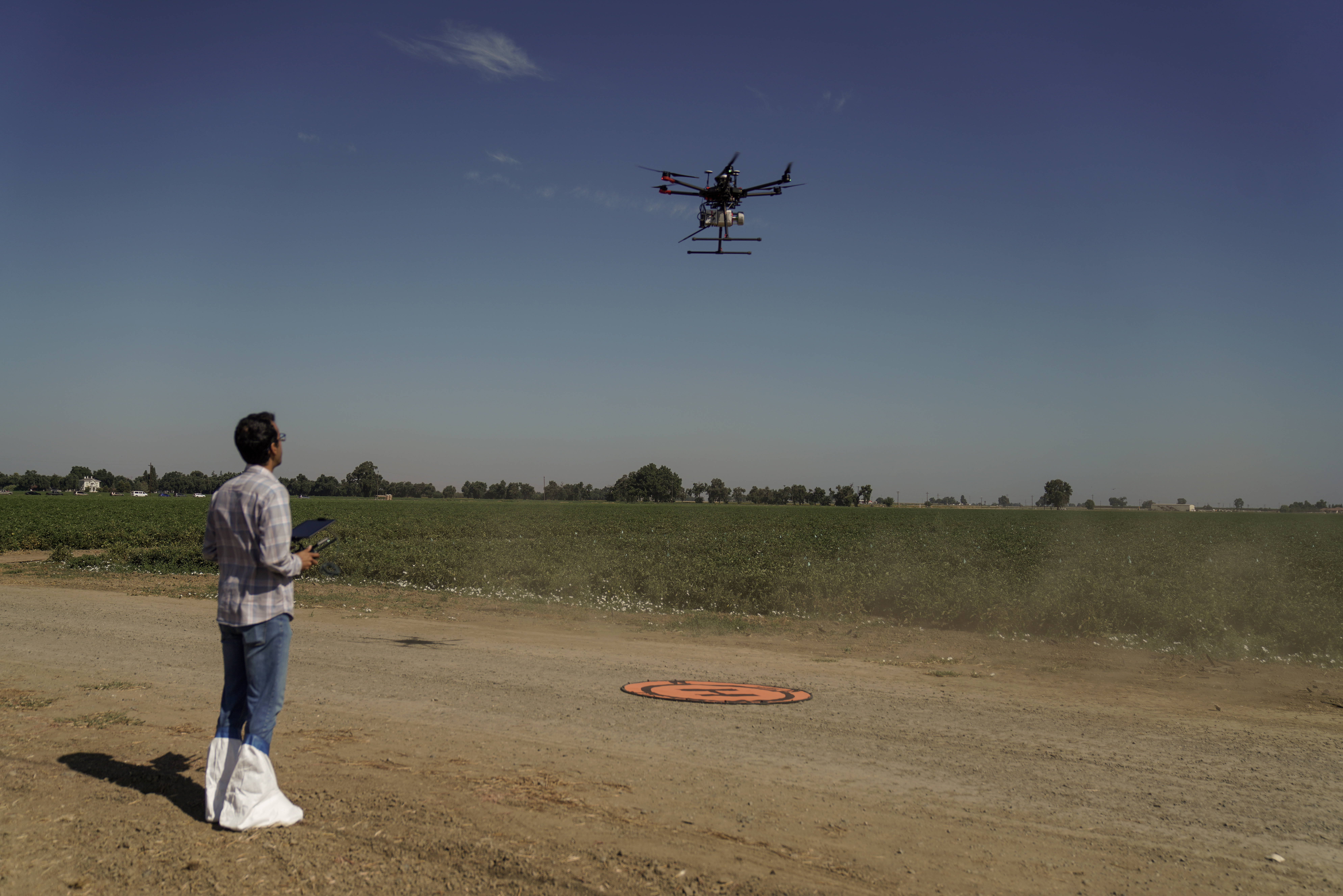
Drone Flight Over Tomato Fields
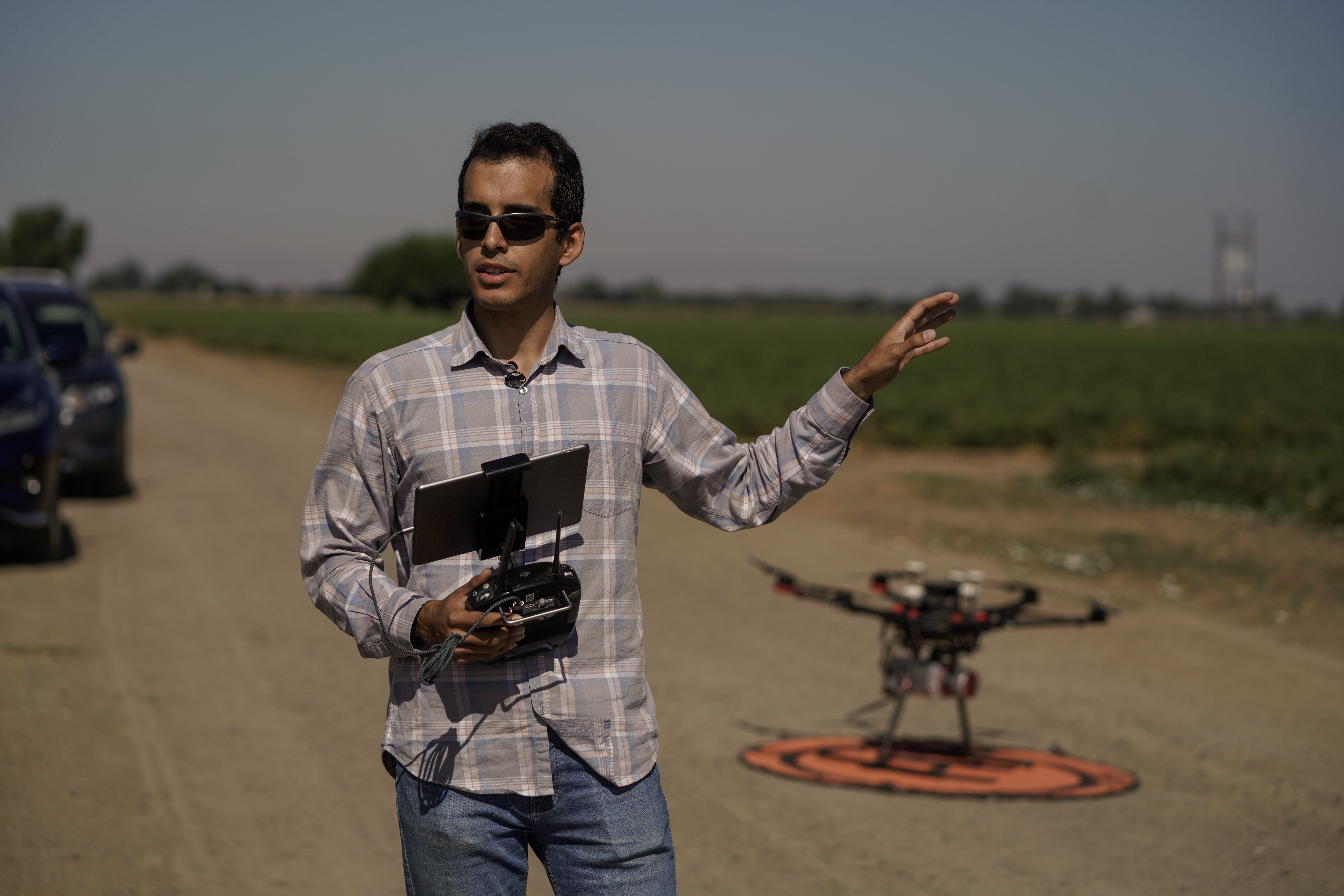
Ground Operation & Field Discussion
Research Integration
This work connects directly with UC Davis studies on:
- Early detection of parasitic weeds in commercial tomato farms
- Biomass and canopy development modeling using 3D point cloud analysis
- Disease and stress detection using multispectral and hyperspectral sensors
- Machine-learning workflows for field-scale tomato monitoring
Combined with drone LiDAR, these approaches provide a continuous monitoring system for field-scale crop assessment.
Citations & Acknowledgments
Primary UC Davis Source:
Dooley, Emily C. (2023). Parasitic Weeds Threaten Tomato Plants on California Farms. UC Davis News.
https://www.ucdavis.edu/food/news/parasitic-weeds-threaten-tomato-plants-on-california-farms
Research Team Contributors:
- Professor Alireza Pourreza, UC Davis Biological & Agricultural Engineering
- Dr. Ali Moghimi, UC Davis Digital Agriculture Laboratory
- Dr. Mohsen Mesgaran, Associate Professor, UC Davis Plant Sciences Department
- California Tomato Research Institute
- UC Davis Digital Agriculture Lab research team
This drone-LiDAR biomass research builds upon foundational studies to create next-generation tools for statewide tomato production.
Research Impact
California tomato agriculture is undergoing rapid transformation.
Through the integration of LiDAR-equipped drones and AI-powered vegetation modeling, we are creating a future where crop stress, parasitic weeds, and yield-reducing anomalies can be detected before they cause damage.
This work continues UC Davis's mission to support sustainable agriculture, advanced field monitoring, and data-driven decision-making for farmers across the state.
Contact & Collaboration
For collaborations, research discussions, or field-scale data collection inquiries:
Mohammadreza Narimani
PhD Candidate, University of California, Davis
Remote Sensing • Digital Agriculture • Drone LiDAR • AI for Crop Monitoring