Enhancing Wildfire Monitoring Through Remote Sensing With Sentinel-2 Imagery and Python Programming
Authors: Quynh Tran, Mohammadreza Narimani, Ali Moghimi, Alireza Pourreza
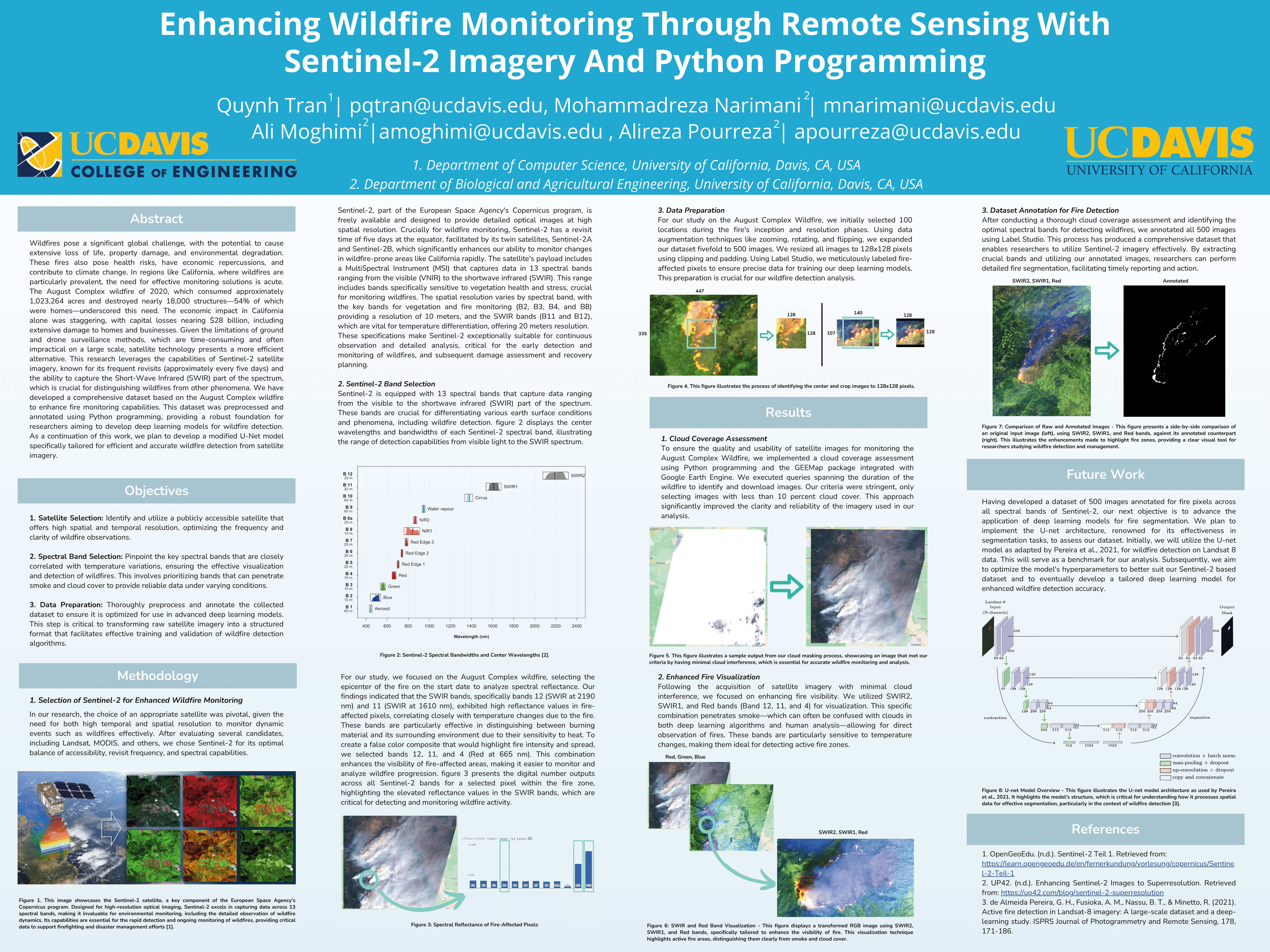
This blog post highlights our poster presented at the ESEARCH program of UC Davis in the spring of 2024. Our project demonstrates a workflow for detecting and monitoring wildfires using Sentinel-2 imagery, leveraging Python programming for preprocessing, annotation, and eventual deep learning model development.
Poster Overview
Click on the poster image below to view the full PDF:

Key Highlights
- Satellite Selection: Chose Sentinel-2 for its high spatial/temporal resolution and SWIR capabilities.
- Spectral Band Focus: Emphasized SWIR bands (B11, B12) for detecting active fire pixels.
- Data Preparation: Preprocessed and annotated 500 images for deep learning readiness.
- Cloud Coverage Assessment: Automated filtering for < 10% cloud cover, ensuring image clarity.
- U-Net Segmentation: Future work includes customizing a U-Net architecture to accurately segment fire pixels.
Sample Code Snippet
Below is a short snippet of the Google Earth Engine script (Sentinel2_ROI_Download_B12_B11_B4.js)
used to filter Sentinel-2 imagery by date, location, and cloud coverage, then export the clipped images:
// Define the ImageCollection
var S2 = ee.ImageCollection("COPERNICUS/S2_HARMONIZED");
var ROI = ee.Geometry.Point(-122.673, 39.776);

// Filter by date, bounds, and cloud coverage
var image = S2
  .filterDate("2020-08-16", "2020-08-29")
  .filterBounds(ROI)
  .sort("CLOUD_COVERAGE_ASSESSMENT")
  .first();

// Export the image with bands B12, B11, B4
Export.image.toDrive({
  image: image.select(['B12','B11','B4']),
  description: 'Sentinel2_FalseColor',
  scale: 10,
  region: ROI.buffer(1000)
});
You can view the entire script in the same directory. This script helps create a false-color composite (SWIR2, SWIR1, Red) that enhances the visibility of active fire areas.
References
- OpenGeoEdu. (n.d.). Sentinel-2 Teil 1. https://learn.opengeoedu.de/en/fernerkundung/vorlesung/copernicus/Sentinel-2-Teil-1
- UP42. (n.d.). Enhancing Sentinel-2 Images to Superresolution. https://up42.com/blog/sentinel-2-superresolution
- de Almeida Pereira, G. H., Fusioka, A. M., Nassu, B. T., & Minetto, R. (2021). Active fire detection in Landsat-8 imagery: A large-scale dataset and a deep-learning study. ISPRS Journal of Photogrammetry and Remote Sensing, 178, 171-186.
We hope this blog post provides insight into our approach for remote sensing of wildfires using Sentinel-2. For questions or collaborations, feel free to reach out!